
First Officer's Log Days 17-19, Utah Expedition
This is the sixth in a series of posts about our recent trip to Utah
15.10.2015 Expedition Day 17
This morning we transited from the Moab location to the Mesa Verde park unit. Upon arrival we were informed that the park is misnamed and should have been named Cuesta Verde as the park is not flat but sloped. We thought to point out to the Rangers it is not particularly Verde either. However, this seemed overly confrontational so we remained mute. We have also now transitioned into the administrative unit of Colorado. This unit is more agricultural than the previous administrative unit of Utah. We found this somewhat remarkable, thus the remarks in the log.
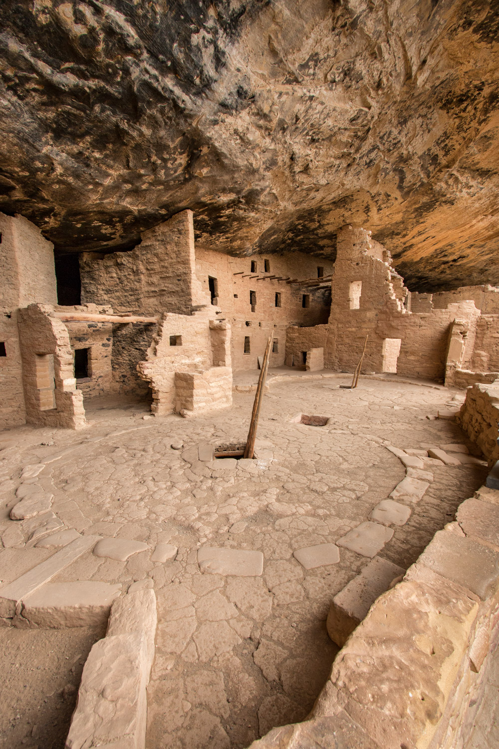
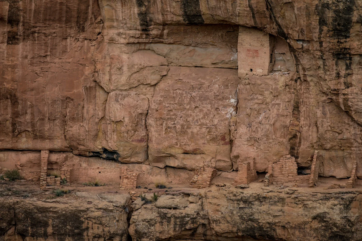
Camp was established in a small valley at a place named Morehead. This Park has passed its seasonal peak and is in the process to enter suspended operation for the cold season. We were able to arrange places on two of the Ranger-led tours of the local archeological points of interest. This park is most famous for its prolific examples of masonry structures created by an ancient civilization in the cliffs within the park. We will tour Long House and Balcony House.
The remainder of the day was spent on a recon of the Chapin sub-unit of the cuesta. We visited the park high point (8572 feet) and several roadside exhibits.
Congratulations to Special Agent (Trainee) Turner on completing phase 1 of training.
16.10.2015 Expedition Day 18
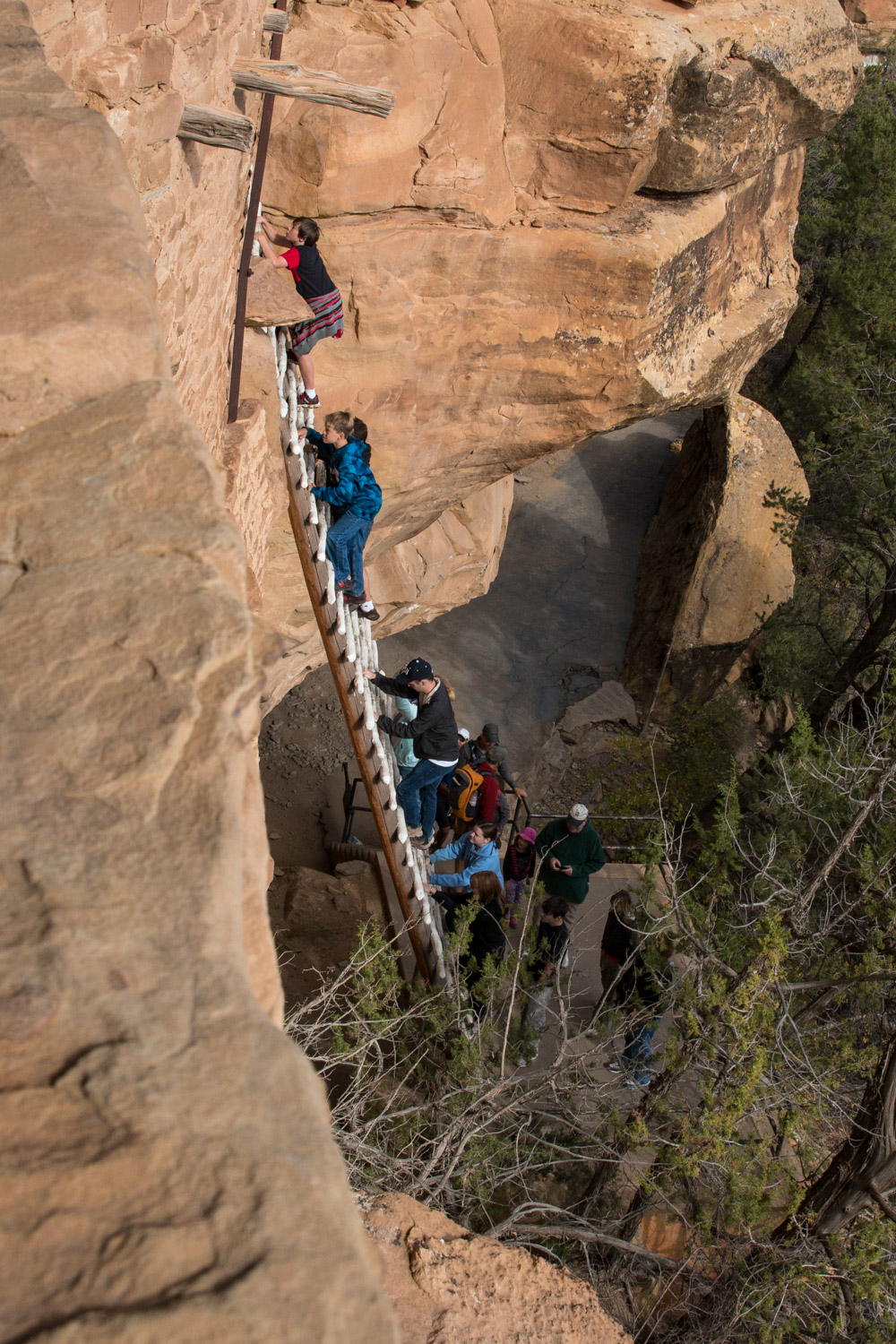
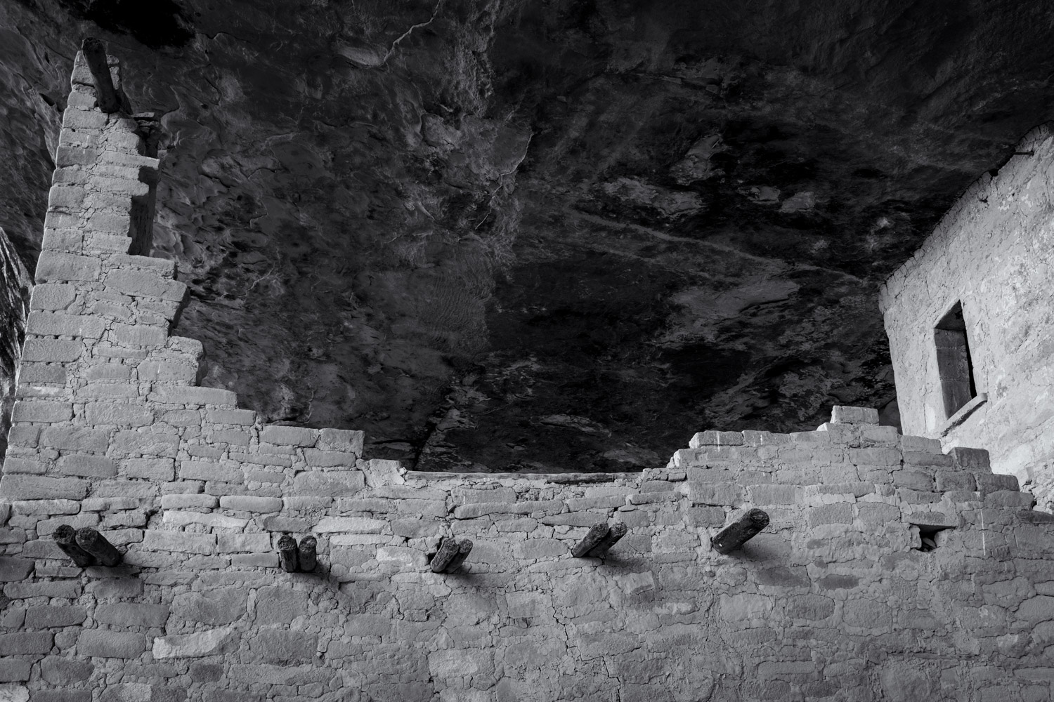
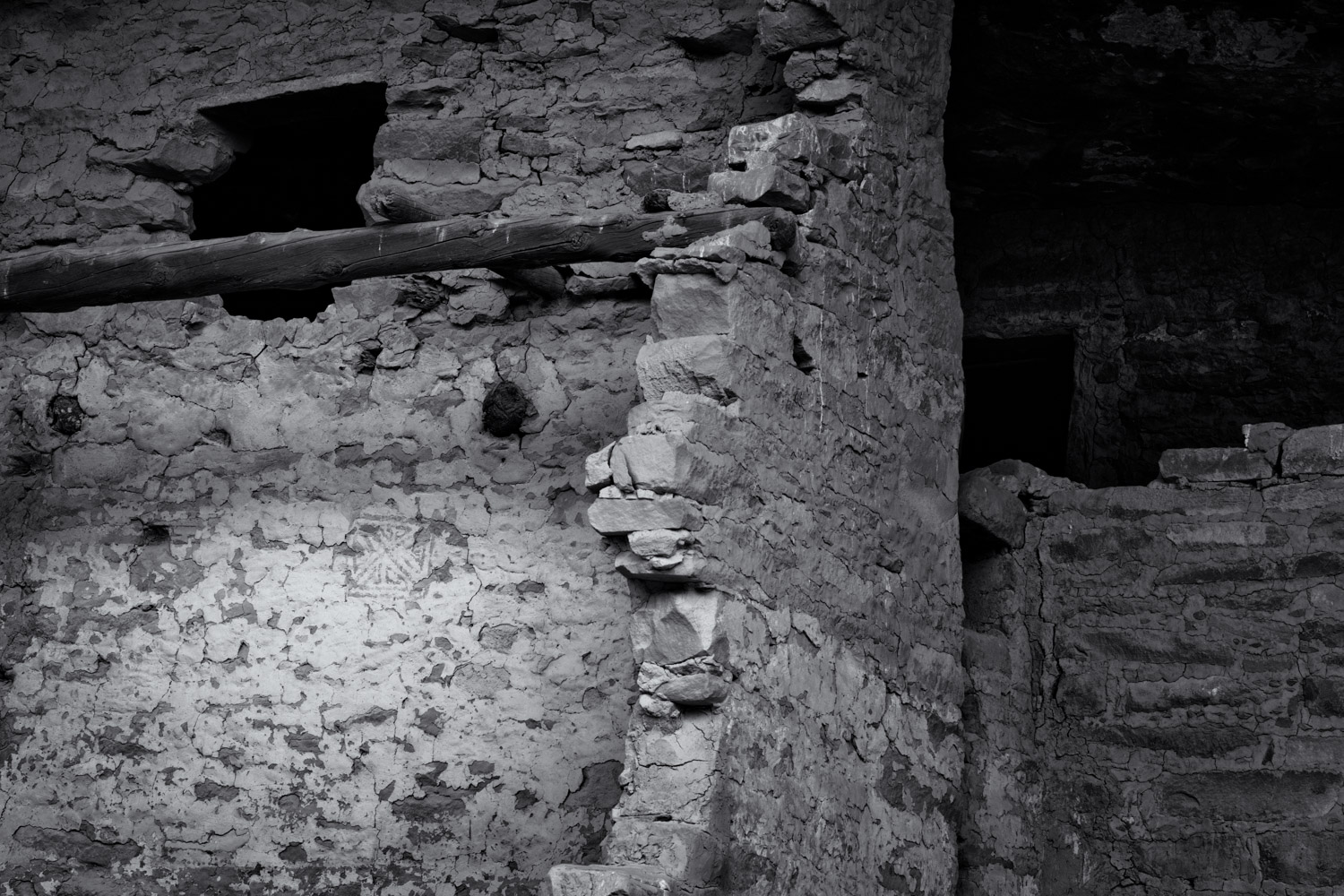
The first major tasking today was the Ranger-led tour of Balcony house. Because the tour location is some distance in travel time away from the camp, this was our first activity of the day. Although this was not a long activity it was somewhat strenuous. There were several ladders, including one over 30 feet tall, and a very small tunnel that had to be transited. The lack of vertigo and agoraphobia were clearly necessary to live in these locations. Image creation sub-task was attempted here but short time available hampered results.


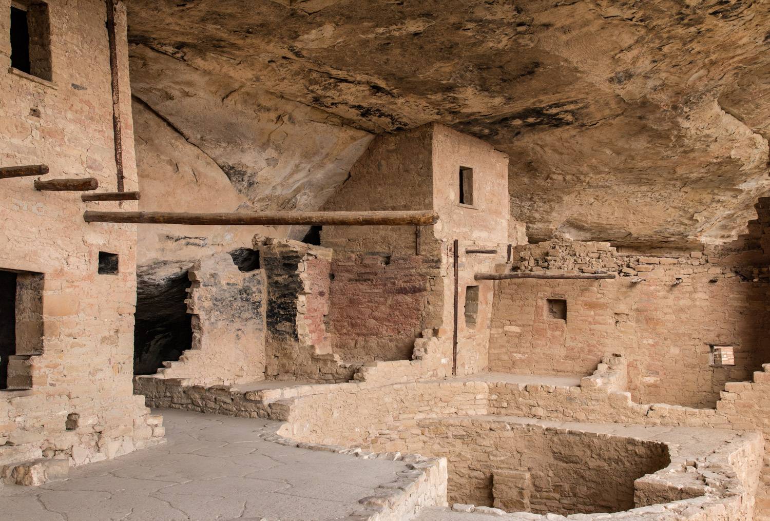

After the tour the crew visited all available displays and structures on the Chapin Cuesta (or Mesa as the locals incorrectly prefer). Foot travel for the day exceeded 7 miles. Many images were created but lighting was poor. We also visited a repository for artifacts. A great many items were on display and there was much verbiage associated with each display. The Captain made a valiant effort to intake and assimilate this information. The First Officer displayed a more lackadaisical approach. The First Officer is counting on there not being a quiz. The museum area was interesting but displayed some other odd quirks. Particularly interesting was the decision of the administrative unit to place a poorly secured metal ramp in the museum area. This may have been intended to attract unsecured small offspring. If so it was quite successful. It was also successful in creating loud metallic sounds; possibly intended for awakening any adult or sub-adult who became torpid after the large quantity of verbiage intake.
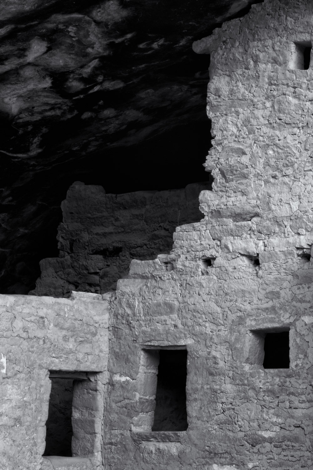
Evening imaging is severely hampered in this administrative unit. Weaponized rangers chase all visitors from the cuestas before sunset. Thus, even though there wasn’t spectacular light we were unable to avail ourselves of any of it near the cliff structures. The crew agrees that this is the second worse park unit for photography after Devils Tower unit. (reference The Prairie Dog Incident in the 13.9.2012 expedition log.)
17.10.2015 Expedition Day 19
Today’s first tasking was a tour of the Long House dwelling remains. This Ranger-led tour was over 2 miles. Conditions were cool and damp. Small group on tour enhanced our ability to attempt images of the ruins without people. After the guided tour, we walked through the Badger Pit House Community. These structural remains are partially excavated and then protected by steel buildings built over the remains. We speculated on how well the steel buildings might last in this climate and if they would hold up better or worse than the rock materials used by the indigenous people. Indications are not favorable for the metal structures. Also in this area was the self-guided trip to Step House. Only ourselves, a ranger and 2 other individuals were at this location while we were there. However, one of these individuals managed to stand every place the Captain was interested in image making. The frustration quotient warning level became elevated.
The afternoon tasking included the self-guided trail to Spruce House. (This site is named for a tree, which is actually a Douglas Fir, which isn’t a true fir. Aspersions were cast on the cowboys/archeologists who named this site and their lack of botanical knowledge.) As this site did not require the public to pre-plan or dispense currency, it was quite crowded. This was quite different from the earlier tour. The ratio of loud children to attentive adults was quite high here, possibly in excess of 5:1. There may have been an inclination among some adults to push these unruly progeny into the thickets of skin-blistering foliage (local name: poison ivy) along parts of the trail. We did not observe any actual pushing or tripping. The frustration quotient warning level remained elevated.
Evening image tasking was scrubbed due to extensive cloud cover and high wind.
Log transmission ends. Standby for future log segment...