Journal

Stories and pictures about our travels, our photography and the outdoors.


Fleet Week San Francisco 2016

Air show, ships, and a beautiful San Francisco Fall day.

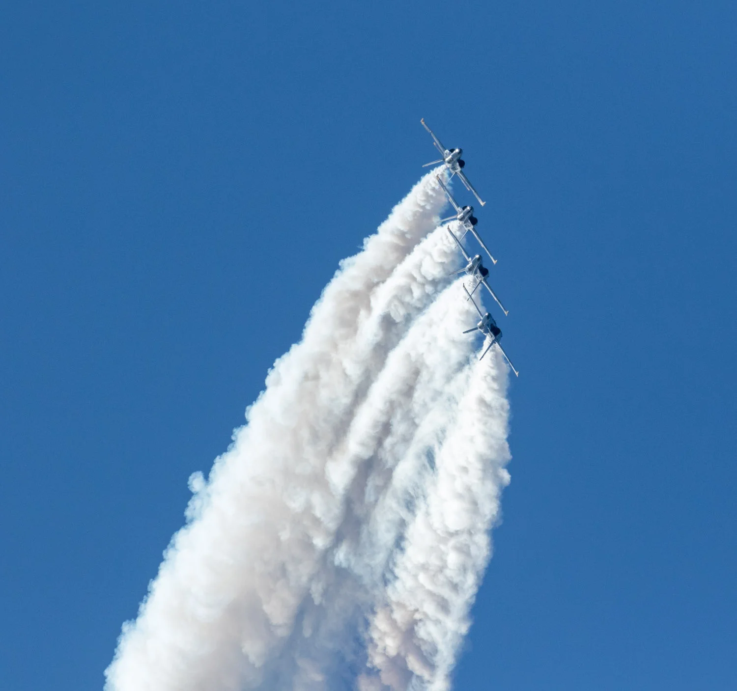
The Breitling Jet Team turns on Alcatraz Island during Fleet Week San Francisco 2016

A friend told us months ago about a special way to see an airshow.  "From the deck of the WWII Liberty ship USS Jeremiah O'Brien out in San Francisco bay, you'll have a great view" she said. Of course we would have to book in advance, gamble on the weather, and take whatever angles were presented to us. But cameras in hand we arrived on a beautiful, clear and warm fall morning.  Soon we were on deck and the ship departed for a leisurely cruise under the Golden Gate Bridge.

The tug Taurus sheperds the USS Jeremiah O'Brien under the Golden Gate Bridge.

After watching the Bridge and the ships and sailboats, we toured the ship including the engine room. This was an up close view of pumping connecting rods, turning shafts, steam heat, and a symphony of mechanical sounds. I only wish I had brought a flash and had more time. It was a fascinating place.

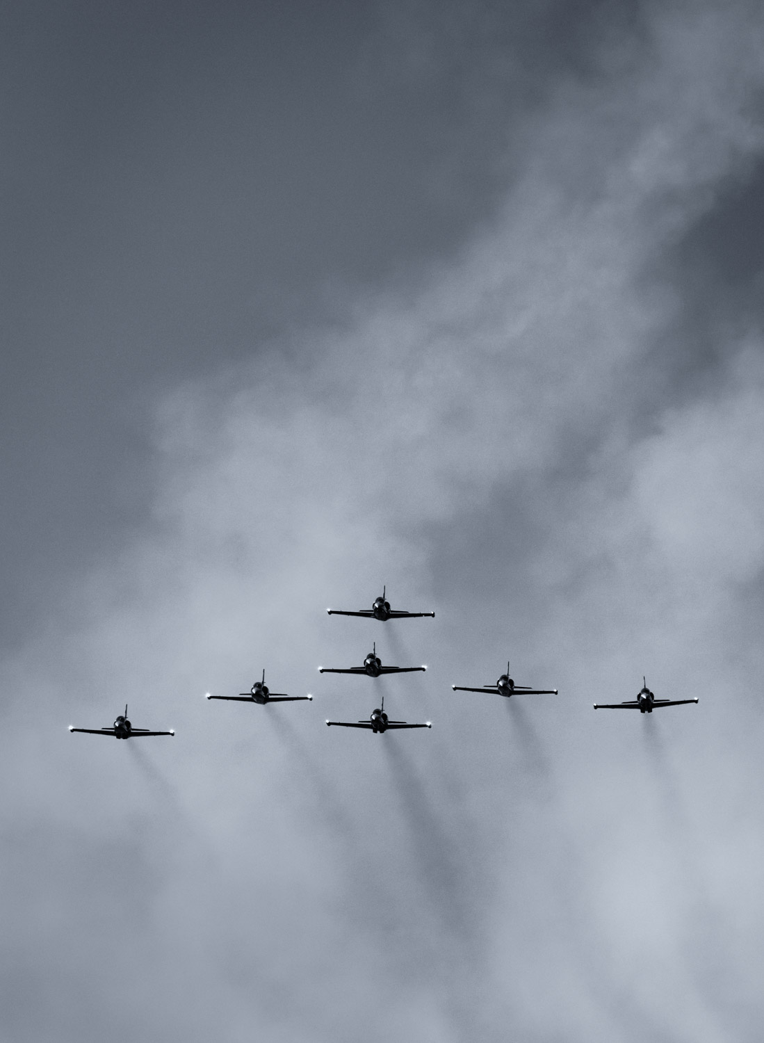
Meanwhile after the tour the ship steadied upon the location we would maintain until after the air show was complete. And cameras in hand we enjoyed several hours of humans doing things even birds only dream of.


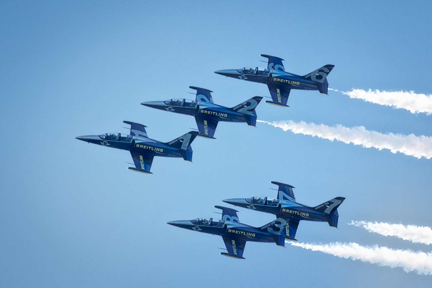
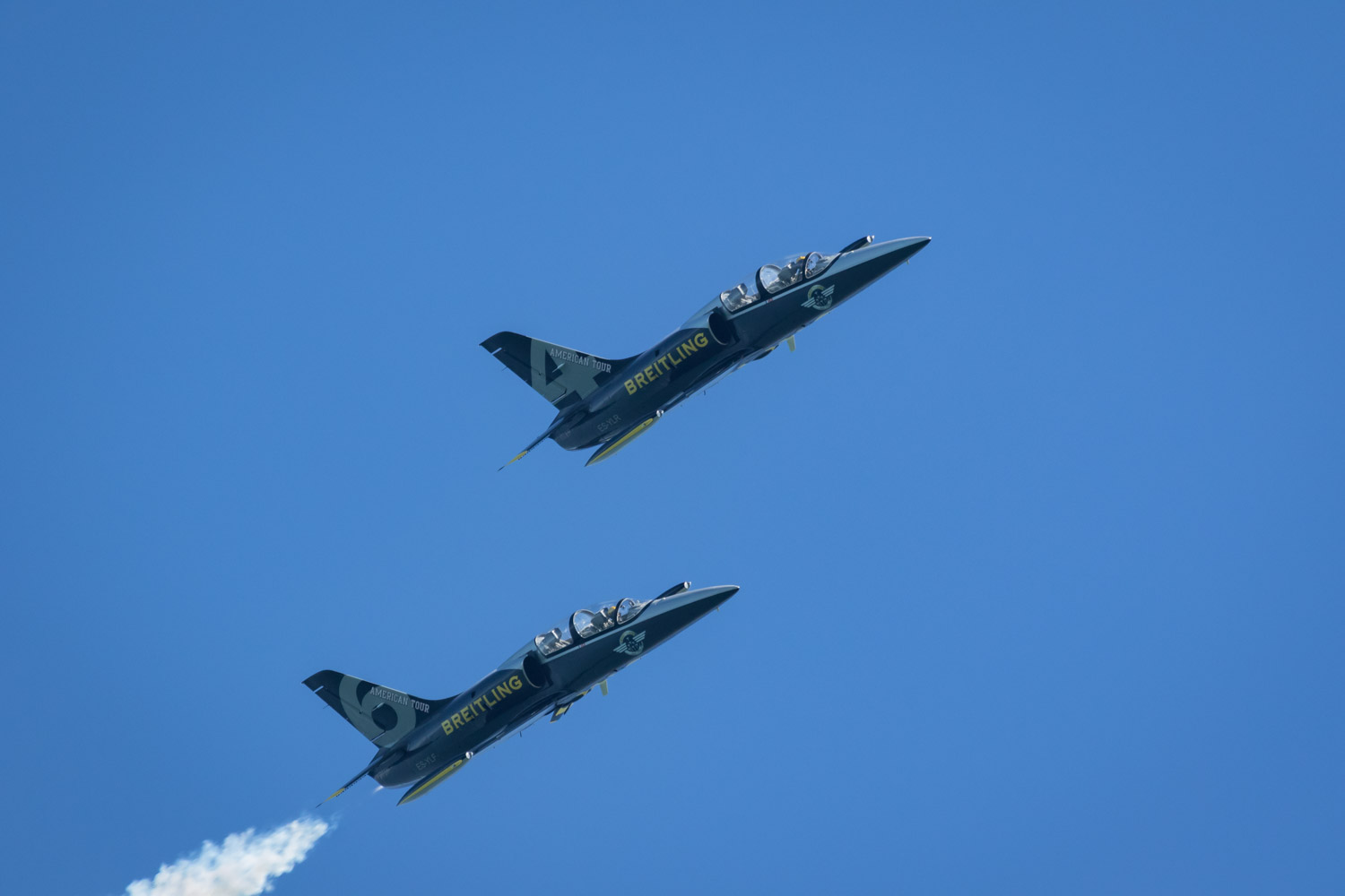
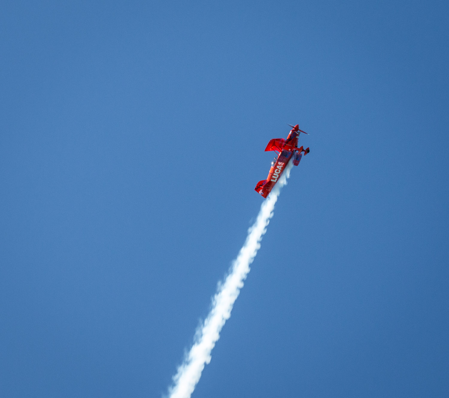
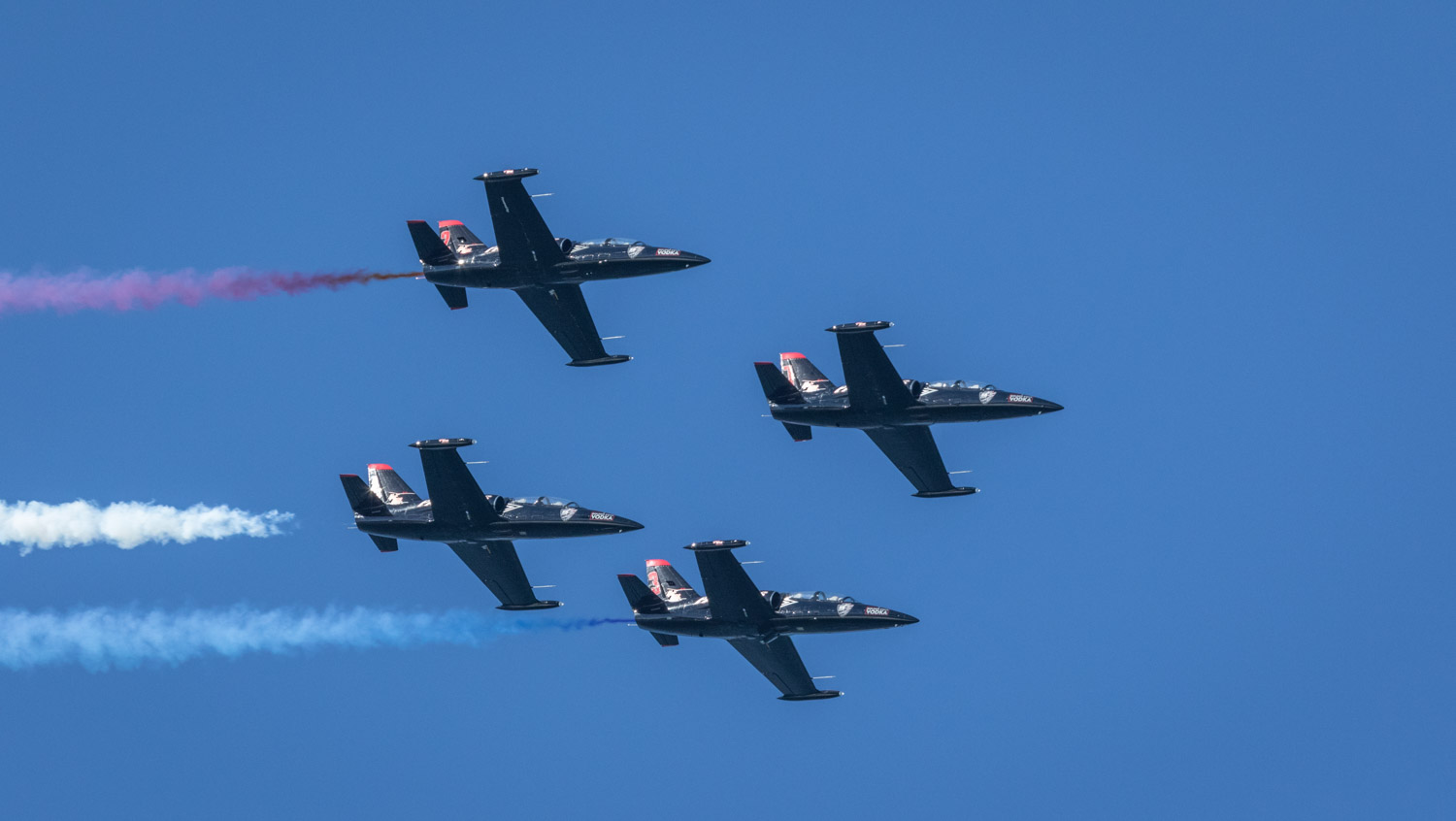
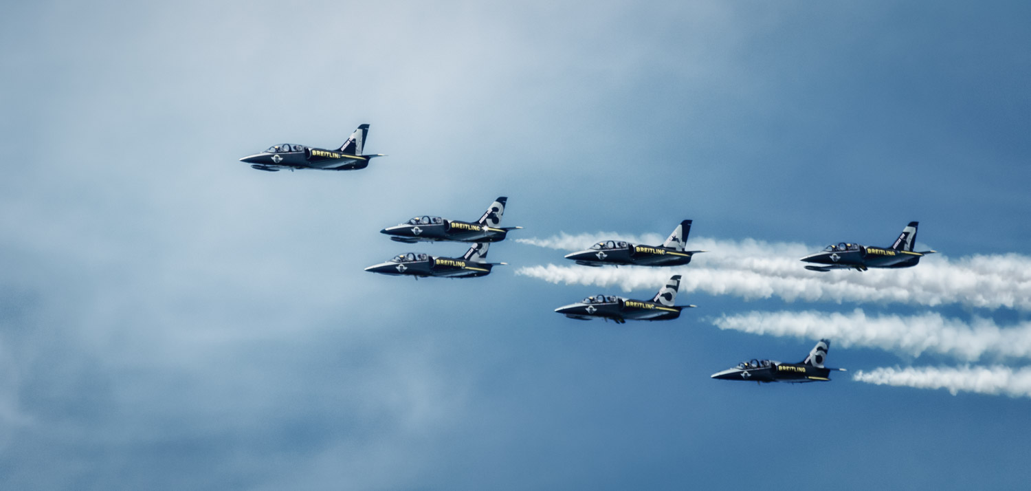
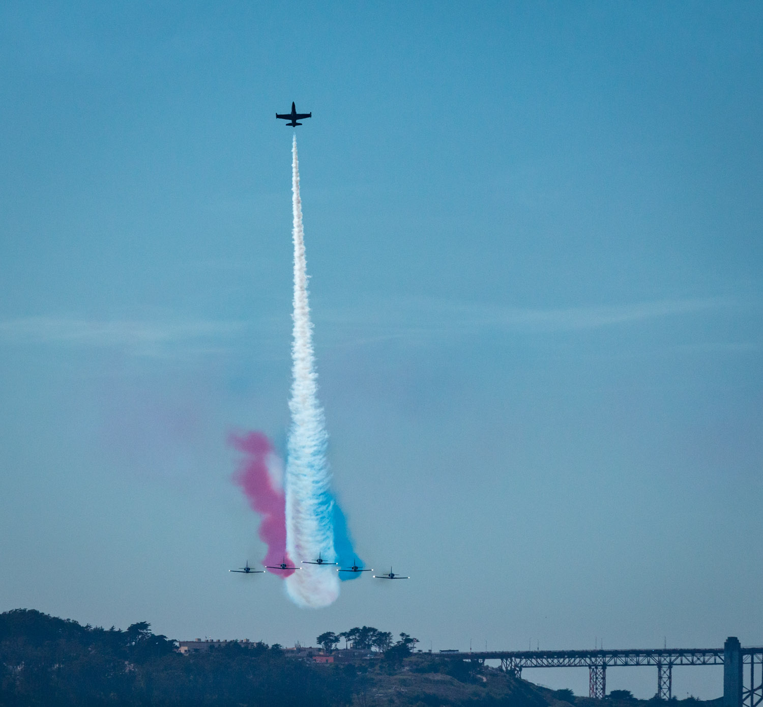
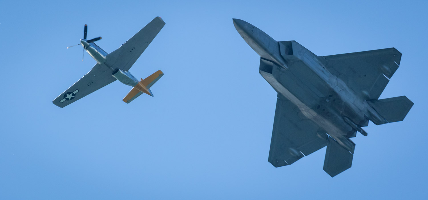
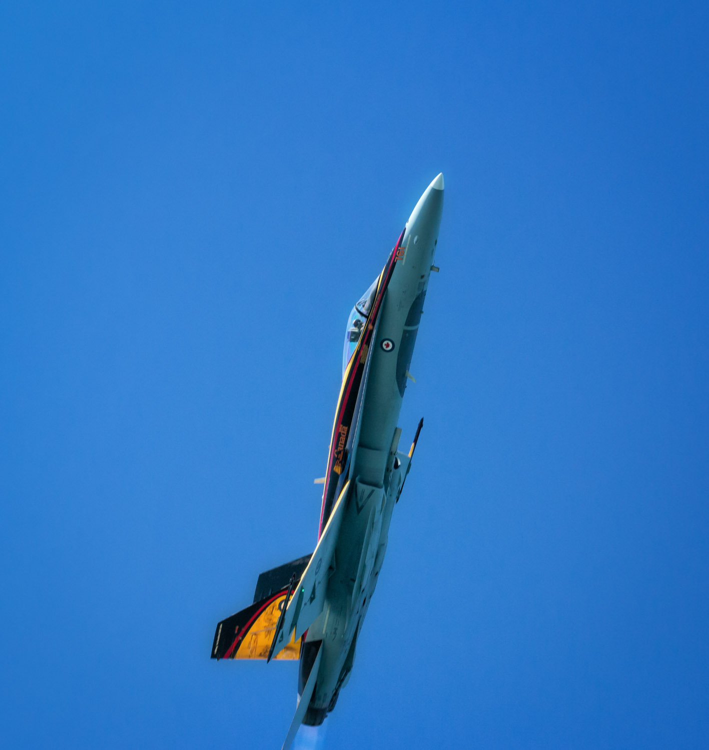
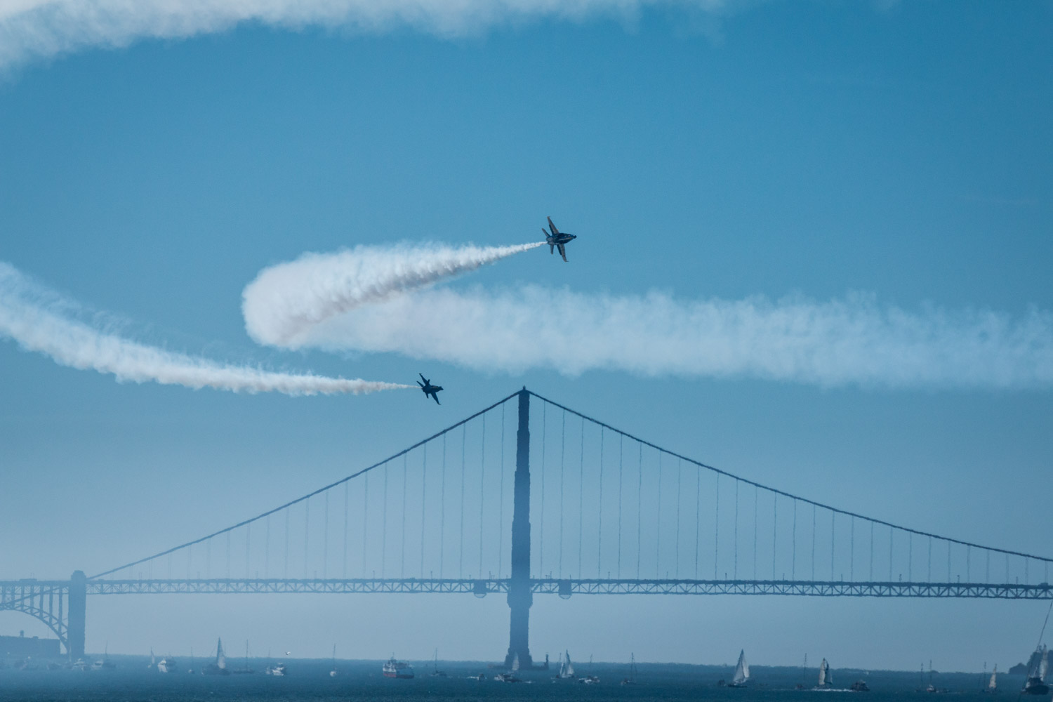
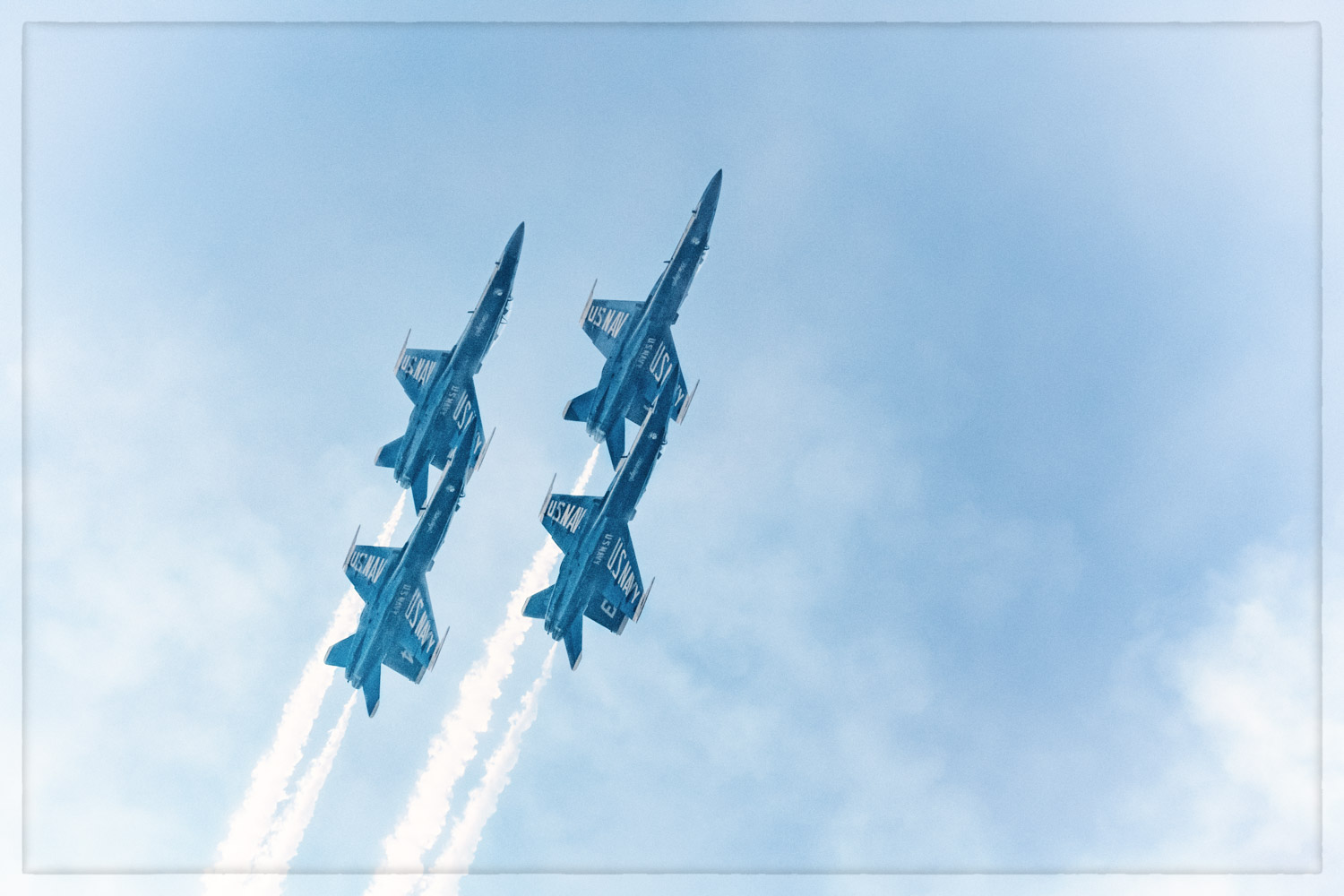
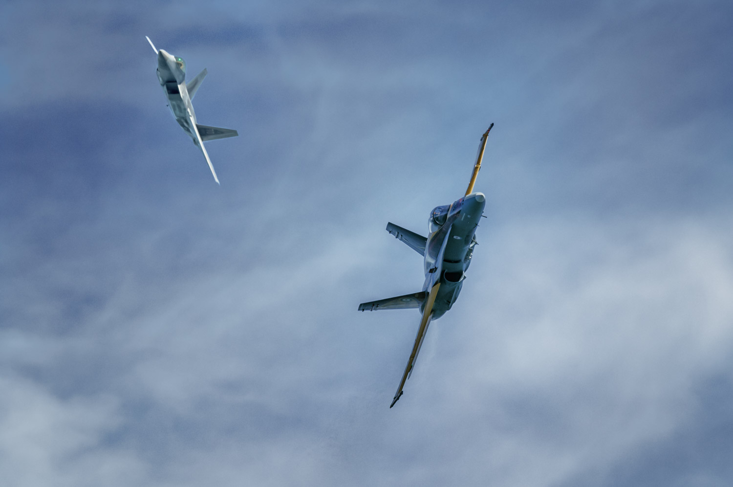
Because we were at the east end of the flight line, the jets would often pass very close to where we were. Very close. As in count the access panels on the bottom of the aircraft close.

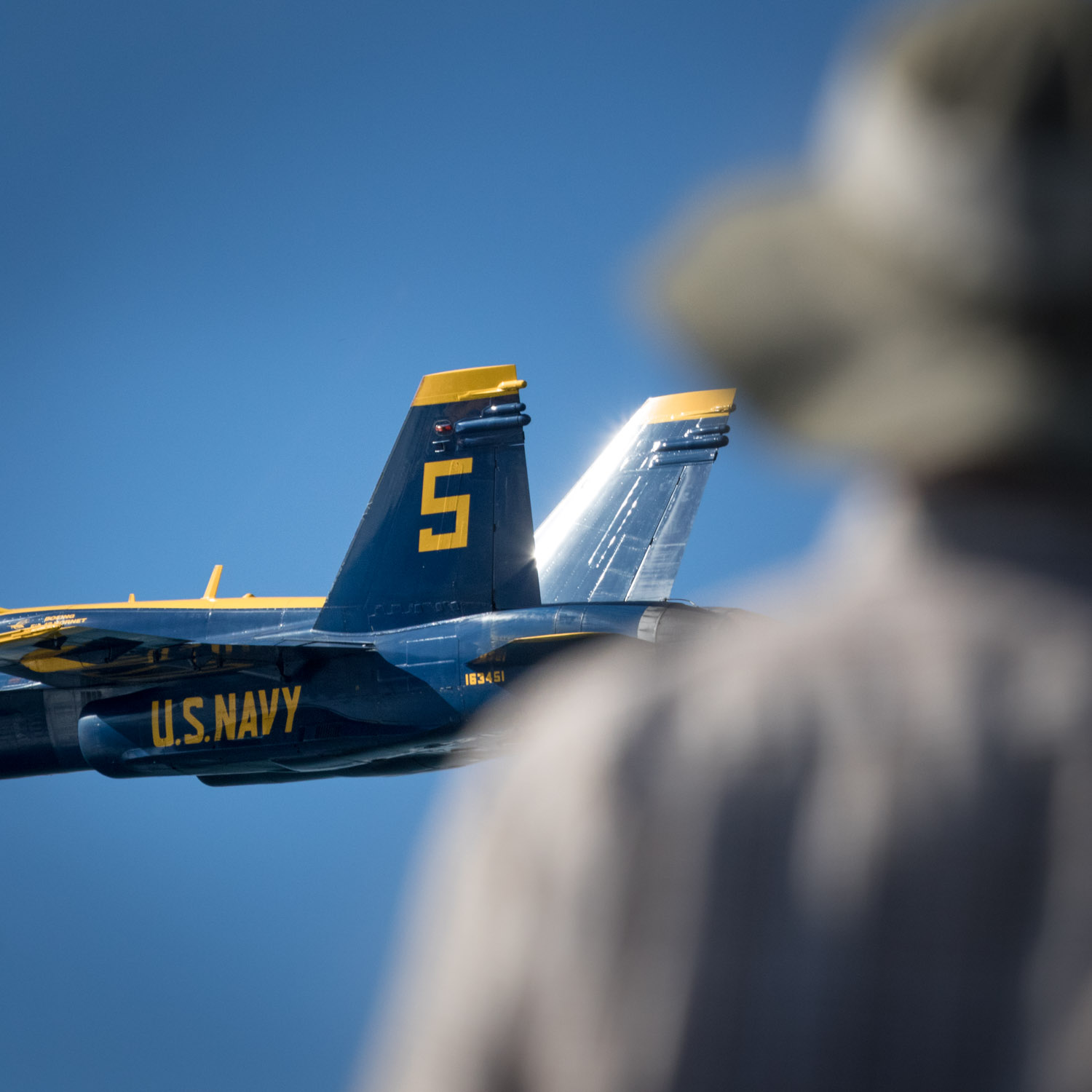
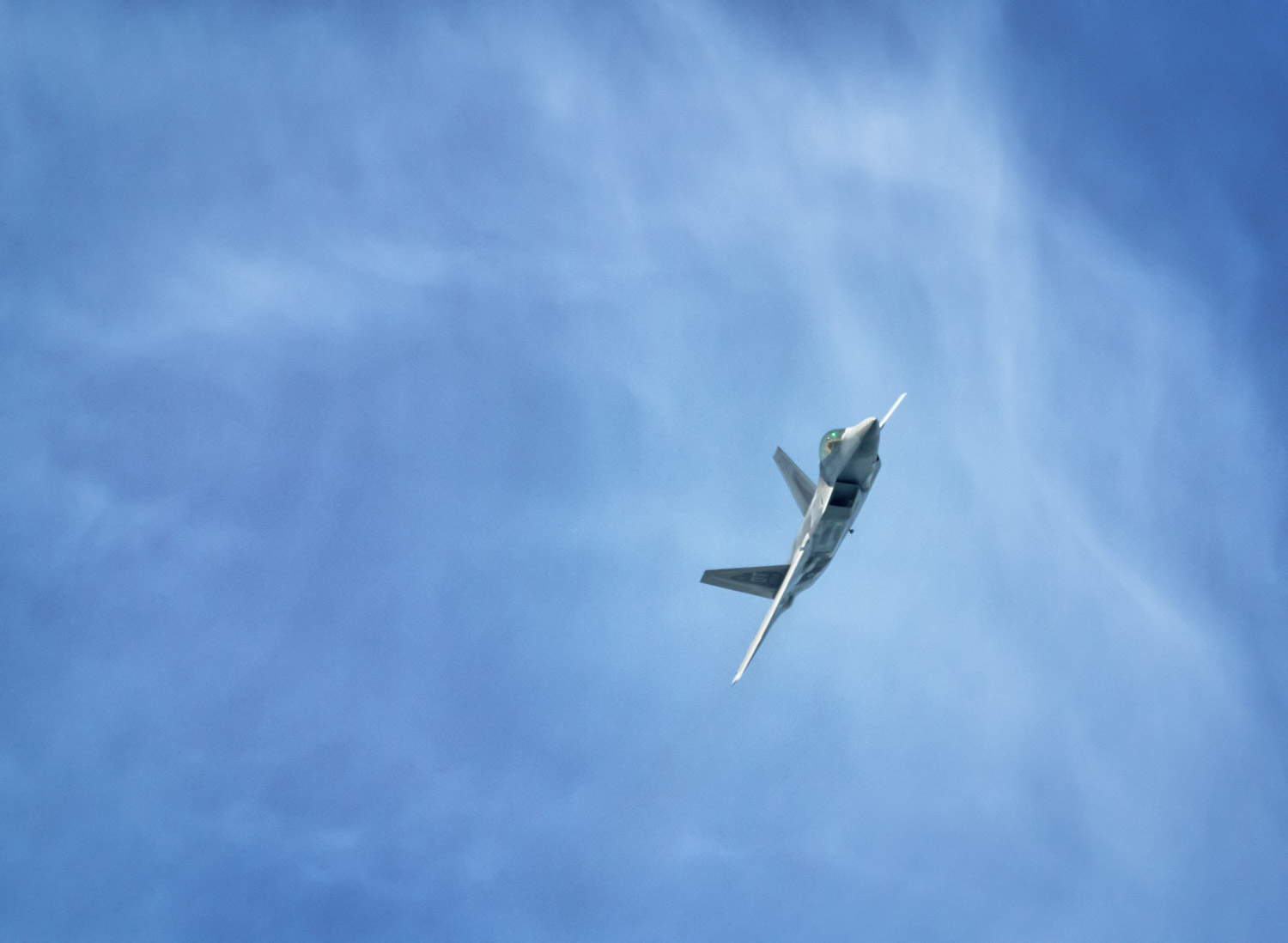
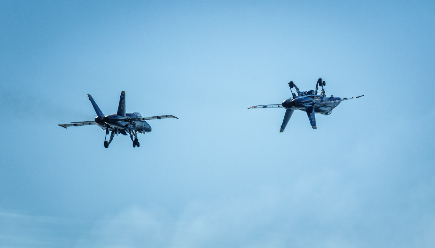
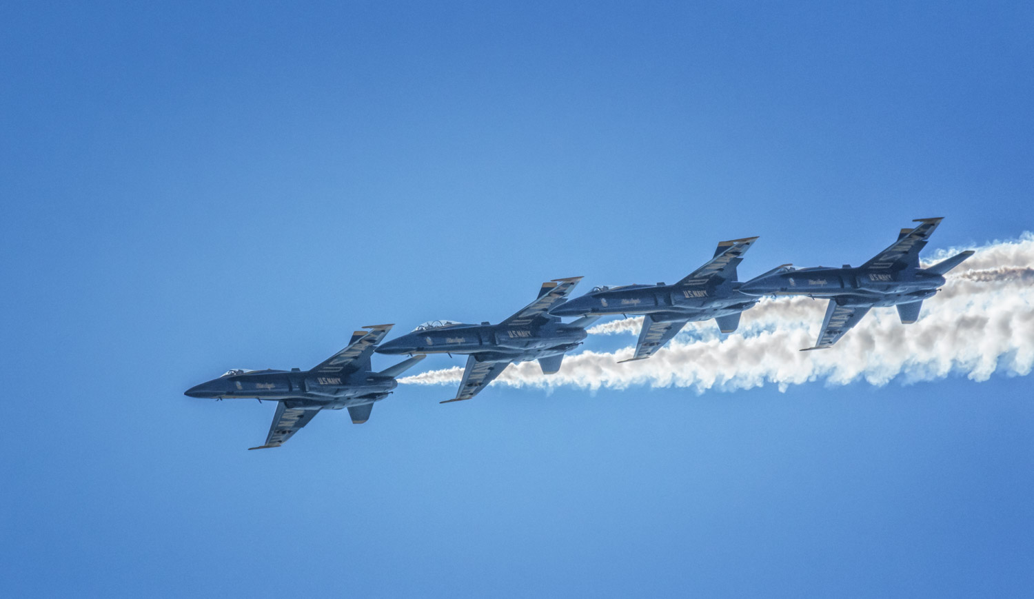
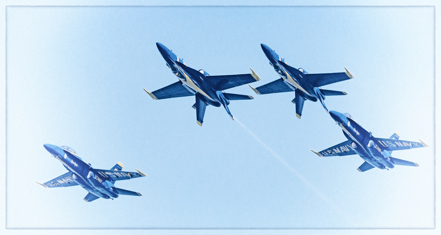
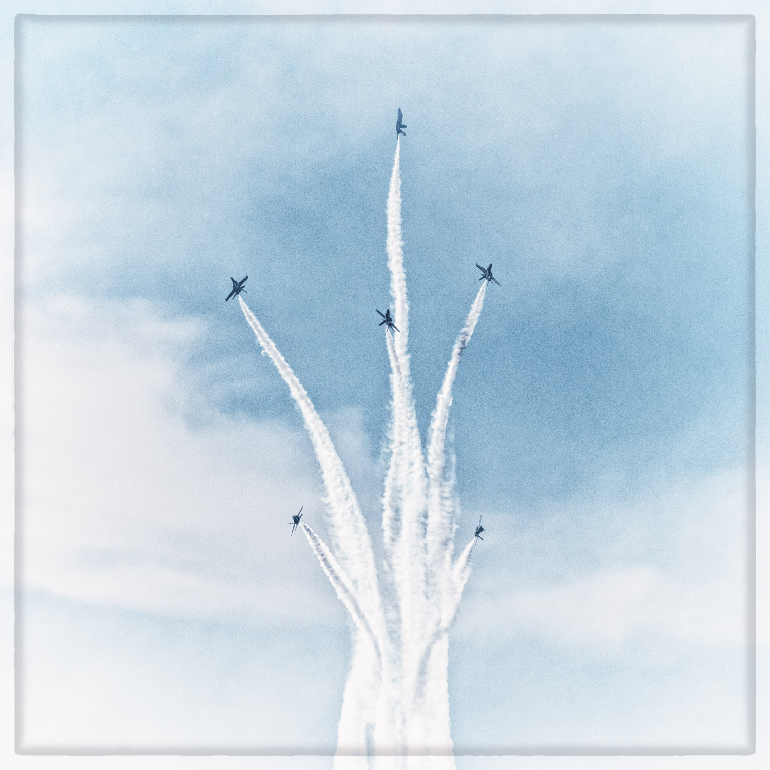
And then there were the Blue Angels. Six F/A-18s bringing the sound of power to the bay with their close precision, high speed acrobatics.

And of course we had to try and capture the feeling of the day in our artwork:

It was a great day to be on the Bay

Boyd TurnerComment
Alien anomaly

We were out this week (last week of July 2016) in and around the Ruby Mountains of Nevada. It was warm, no, it was hot. Can't sleep hot. We tried to get some pictures of the Milky Way over the marshes of Ruby Lake National Wildlife Refuge but the weather wasn't cooperating. Clouds and haze were were making it hard to see the Milky Way. Suddenly, a very bright light appeared in the west moving toward the east along the southern horizon. It looked like very bright airplane landing lights, but there was no sound. Then an exhaust plume began to form behind the light. Within a minute the light became a long trail and started to break-up into smaller pieces. But still the light was bright enough to light the clouds and throw shadows on the ground. Eventually the light disappeared over the southeastern horizon.

Fortunately, the cameras were on the tripods, the remote cable releases in our hands and we were able to get some photos of this celestial event. We put together a video of the approximately two and a half minute event. Hope you enjoy it.

Boyd TurnerComment
Lower and slower

The oldest form of controlled human flight is the hot air balloon. (Most boys have experienced uncontrolled flight by the age of 4 but that is another story.) The French first made balloon flight work in the 1700s. Since then the principle hasn't really changed. Fill a bag with hot air and attach it to a basket. Add people to the basket and use the hot air and the wind to blow you somewhere else. Of course nothing is really that simple, but it is sure simpler than some other forms of flight. The perspective is also different than most other forms of flight. The view is lower, and slower, and vibration free. Even the sound is different - the sound of the burners igniting and pushing hot air up into the bag, then quiet except the sounds from the ground below you. Quiet is not generally associated with other forms of flight. Even sailplanes have a constant sound of air flow.

This lower and slower and quieter form of flight fits nicely with how I like to do photography. I like slower and quieter. And lower is certainly more scenic than 35,000 feet. In the middle seat. In front of the 2-year old on his fathers lap. For what seems like 237 hours.

Hopefully these photos share some of the feel of hot air balloon flight. Lower. Slower. More peaceful.
Boyd

Boyd TurnerComment
100 plus years of National Parks

This is the 100th anniversary of the founding of the US National Park Service. So we decided to celebrate the parks by putting some of our photos from the parks together in a slide show. For this day and age it might be a little long at just over 7 minutes with credits. Or just long enough to enjoy your favorite beverage adult or caffeinated. Attached is a link to the HD version of the slide show on YouTube. We hope you enjoy the slideshow and enjoy and support our National Parks

From behind the wire

On April 19, 1987 the last remaining wild condor was captured and removed from the wild. There were 22 condors still alive. Twenty-two. Behind the wire. The last passenger pigeon and the last Carolina parakeet died behind the wire. It looked like the California condor might suffer the same fate: an ignominious end to a species.

Fast forward to December 2015.

There are 435 California condors alive as of December 31, 2015. That's almost 20 times the population size in 1987. And 268 of those birds were in the wild, outside the wire. In California, there are 155 individual condors in the wild. If you travel to the wilds of central California you stand a chance of actually seeing one or more, outside the wire.

March 2016, found us on the road to Pinnacles National Park. We knew we would be in the heart of condor habitat, but would we see any? The first stop in almost any National Park Service unit is the fee booth, where we asked: "Seen any condors?"  "They've been roosting in the evenings on top of that ridge above the campground." Cool. That evening we looked up at the ridge and saw a flock of large dark birds soaring on the currents.  We're not sure how to describe seeing the wild condors flying about ½ mile away.  They certainly were not attractive with their puffy, swollen red heads (adults), but they were nonetheless impressive in size, soaring on the thermals with their two flat, surfboard wings, decorated at the ends with long “fingertips”.  Nearly twice the size of the turkey vultures they hung with; helping us comprehend the scale of these gigantic birds with their 8.5 – 9.5 foot wingspans.

We saw two more soaring high over the Park the next day as we hiked the peaks. We also encountered a biologist from the Pinnacles condor crew monitoring some of the individual condors' radio transmitters. We had a nice conversation with the man and we noticed other hikers also engaged him in conversation. The biologist was a good ambassador for the condor recovery program. He and his co-workers have much to be proud of. The recovery program is a triumph of wildlife management.

The next morning we were fortunate to see nine condors up close when they landed in trees a couple hundred feet beyond the campground.  The first time they’d landed there according to members of the condor monitoring team who were also watching.

Later as we drove off we tried to settle on a word to describe the condors.

Playful - we watched their antics for over an hour while they warmed up in the morning sun. 

Curious – which gets them into trouble picking up tin, lead bullets and other indigestible and poisonous human trash.

Social – picking at each other, pushing and pestering younger condors (with black heads) off the tree, and interacting in ways we could not interpret. 

Clumsy - using their chicken-like feet, wings, and beaks to help climb the branches.   

Ponderous - considerable effort to flap those oversized surf board wings to take off between protruding branches and other obstructions; a nine-foot prehistoric creature ascending directly overhead. 

The best word to describe them –

Majestic -

... and outside the wire!
 

Boyd TurnerComment
A Charm of Finches

Birds. We like birds. We are not fanatical about it. We aren't even close. We know people who will drive several hours to see a rare bird. Okay we have taken the occasional trip to see new birds we haven't seen before but it isn't like we get all gooey and squishy inside when we hear there is a black-headed gull hanging out at some local dumpster. But still, we can get excited when a new bird shows up in the yard.

The other day it was an odd finch. Not odd as in: "Johnny Depp is an odd human". Odd as in: "You all aren't from around here now, are ya?" kind of odd. This wasn't our usual finch. It wasn't a goldfinch, not a house finch either. And it wasn't one of the large gaudy grosbeaks. So what to do about it? Dig into the bird books.

After multiple consultations of photos, drawings, paintings, descriptions of plumage, consulting range maps, examining bill characteristics, and some waffling we settled on an identification. A female purple finch had come to visit our feeders. Sure most people wouldn't care that a purple finch showed up with the house finches. Heck, most people don't even know that there is a difference between a purple and a house finch. And there's a Cassin's finch too? Whaaattt? Yet, if you are interested in the non-human part of the world, you probably find these differences fascinating. Darwin changed the world after spending time among the finches. One of our bird apps says in North America there are 89 species of the family Fringillidae (the taxonomic family finches belong to). We also learned that a group of finches is called a charm. Seems about right.

Female purple finch

American goldfinch

House finch

Evening grosbeak

Pine siskin


Boyd TurnerComment
Where did it go?

"Did you hear? The Turners changed their website"

It was time for a revision. Sometimes you just don't like something so much. Maybe you finally outgrew that boy band. Maybe you got tired of bell bottom pants or maybe it was time for a new paint scheme in the house. Maybe you have a new shiny toy you really like.

So we have revised the photography section of this site. Basically, we had some newer photos that we felt were worth sharing. We also wanted to get our favorites from 2015 into one place. Out with the bell bottoms and on with the new paint.

Sure, change can be hard. Maybe you really liked that boy band. Hopefully, you can find new favorites here.  (No new boy bands though.) Please, if your favorite photo is gone send us a comment with a description of what is missing. No promises, but maybe we will put it back up. And who knows, maybe we will get something even better up soon. So come on back often. You never know what might be added.


Boyd TurnerComment
First Officer's Log Days 23-26, Utah Expedition

This is the eighth in a series of posts about our recent trip to Utah

21.10.2015 Expedition Day 23
Continued overnight cloudiness, rainfall and thunderstorms precluded the morning sunrise imaging tasking. We drove to the prime imaging spot of Dead Horse Point. Visibility was limited to 100 feet or less by dense fog. The Crew then returned to the VC for this park unit. The crew was trained in additional geologic information and in the intricacies of the adjacent KCl (potash) mining operation. Even after our training was complete, dense water vapor mostly obscured the view at the VC. Increased airflow along the cliff walls did result in some clearing and some imaging was accomplished. The Crew again returned to the Point of the deceased equines.

A note here about this local place name. Apparently, the Point area was a capture, sort and cull location used by local cowboys to obtain new equine genetic stock from groups of feral equines. Non-selects were left to expire as there is no surface water (other than small pools of rain water), hence the term Dead Horse Point. Of course this still leaves open the question why the term cowboys. Why not horseboys? Or presumably the work was not that of child laborers and the term horsemen is most appropriate. And since there were apparently multiple non-selects among the feral horse population (named broomtails) why not Dead Horses Point or even Dead Broomtails Point. The Crew is still confused by naming conventions in this area.

As the Crew returned to the observation point at the end of the road, in the area of the deceased, poor genetic quality equine selection area, the water vapor was still not dispersing. The Crew made the decision to transit around the transportation system to the Canyonlands Park unit. The Upheaval Dome foot recon was accomplished. This geologic feature is claimed to be a result of a small meteorite strike. Originally this was thought to have been from a bursting bubble of salt from the underlying salt layers, sort of a geologic zit. The Crew found the meteorite scar theory more heroic. Regardless of source, the trail across “slick rock” sandstone to steep overlooks into the colorful crater was entertaining. Imaging equipment was deployed.

Upheaval Dome detail

Rain pours over the canyon walls near Upheaval Dome

For the evening image tasking we returned to the Grand View Point Overlook at the southern end of this sub-unit’s vehicular transportation system. Imaging equipment was deployed. However, a broken wall of gray, stratified clouds remained in the west restricting lighting to small spots of low brightness in an otherwise moderately shadowed landscape. Lighting was neither colorful nor bold. Imaging results are not expected to be good.

Returning to Collect the Good Equines, Leave the Crummy Equines to Die Point SP more rain showers were encountered and very distant lightning observed. As the planetary satellite is approaching full luminance, stars are becoming difficult to see, additionally high cirrus is obscuring faint stars and astronomical features. Post-sunset imaging is again cancelled.

22.10.2015 Expedition Day 24
Although a transit day, we planned to implement sunrise imaging protocols in the hope of finally catching beneficial lighting. Again, overnight rain left the area covered in overcast and pockets of water vapor. The VC observation point was checked and deemed unsuitable. The Point of the Deceased Broomtails was checked and also found to be unsuitable in dense water vapor. However, a break was noted en route to camp and the First Officer took a limited subset of the imaging equipment and made a quick foray to the canyon edge. He was able to observe some marginally satisfactory lighting conditions and an ephemeral waterfall. However, the Captain assumed the First Officer had exceeded the allotted time for his task and run afoul of poor footing ultimately ending in his untimely demise. After only a few moments the crew reunited. The First Officer thought the Captain somewhat frantic. The Captain was not amused. The First Officer may be in trouble.

As this was a transit day, camp was packed (in a moderate rain) and the Puma Palace and Power Unit “Buzz” departed for the political subdivision of Nevada. In preparation for this leg, the Captain had procured a text on geology visible from most of the route we would be travelling. Reading this book we became familiar with terms such as Laramide orogeny, overthrust, crossbedding, backthrust, splay, dip, bed. We suspect geologic terms were developed by single, frustrated, males.

The Crew made bivouac at the Cathedral Gorge SP in the Nevada political unit. This park is an eroded large water channel near the village of Panaca. Rain showers were observed in the area but not experienced at this site. The Captain deployed imaging equipment to record the colorful cliffs. The First Officer observed the local avifauna. No highly unique species were observed by the First Officer. Also observed were training sorties by Gen4 aerial vehicles (F-16 and F-15). Although the First Officer hoped to observe Gen 5 vehicles (F-22, F-35) none were observed, possibly cloaking devices were deployed. As sunset approached a unique phenomenon was observed as one of the aerial vehicles transited through a cirrus layer. Shock waves from the craft caused the clouds to refract light differently resulting in multi-colored reflections similar to the effect referred to as a “sun dog”. Sunset itself was quite spectacular. Unfortunately, foreground and midground elements were not conducive to fully capturing an aesthetically pleasing image. The Crew strongly wished this sunset had occurred at one of the previous bivouacs.

It is noted ASE Scottie offered Prospective Crew Member Intisar permanent social bonding status. Prospective Crew Member Intisar accepted said offer and has been promoted to Crew Member Specialist (Biological) pending ceremonial confirmation. The crew of the USS Puma Palace congratulate ASE Scott and CMS (B) Intisar on their pending new status. Additionally, we again welcome CMS (B) Intisar to the crew.

23.10.2015 Expedition Day 25
This was a transit day across the political unit of Nevada. The crew transited the Extraterrestrial Highway. No known aliens were observed. We did observe the local bovine race being harassed by a low flying aerial vehicle referred to as a helicopter (specifically a Bell 47G model). Would the individual conducting these flight ops be referred to as a cowpilot or a chopperboy? Probably not a Bellboy as that is a different occupation. We are unsure. Camp was made for the night at the same facility used previously at the community designated RNO. Again, sunset was better than at all locations in the Utah subdivision, Dinner included a local preparation involving raw fish.

Note to crew: No gorging on raw fish prior to days involving long transit periods as the phenomenon referred to locally as “fish farts” is likely to ensue.

24.10.2015 Expedition Day 26
The crew returned to the assigned permanent docking facility. Members of the Sciurid clan greeted us on arrival. Although the Puma Palace is somewhat the worse for wear, at least partially due to previously noted phenomenon, the mission was deemed successful. Maintenance period starts tomorrow.

Log transmission complete. Awaiting further orders.

Boyd Turner Comment
First Officer's Log Days 20-22, Utah Expedition

This is the seventh in a series of posts about our recent trip to Utah

18.10.2015 Expedition Day 20
Today is a momentous day for this expedition. It marks the end of our eastward progression and the beginning of the return towards Puma Base. Rain occurred overnight. Although the quantity was limited, we were glad not to be in the structure other expeditions utilize. This structure is known locally as a tent.

We returned to our previous bivouac at the berg of Moab. After establishing our camp, we returned to the administrative park unit referred to as Arches. We were able to concentrate on the image tasking in the areas of “Park Avenue” and “The Organ”. The crew felt both areas were misnamed. We never really absorbed the name “Park Avenue”. It seemed that Wall Street was more appropriate: giant cliffs of red (ink? – Note check Crew financial planning on return.) We didn’t see the musical instrument in the Organ. Didn’t see any internal body parts either. We remain skeptical about the sobriety of the person in charge of naming conventions.

Evening sunset image tasking appeared to be a bust. We waited at the “Fiery Furnace” for sunset. However, a massive wall of gray, undifferentiated cloud rose up out of the west and squashed the hopes of either an interesting sunset or any interesting light. This makes two evenings in a row when sunset light was rated “poor”.

19.10.2015 Expedition Day 21
The crew was awakened to the sound of thunder, not far off, we didn’t have to wonder. Camp was quite noisy with the overhead storm and moderate rainfall. Again we were thankful the expedition was not in “tents” during the somewhat intense storm.

This was also a moving day. The crew moved to the west and increased elevation significantly by moving camp to the Dead Horse Point State Park. This park is relatively small but is adjacent to the Island in the Sky sub-unit of the Canyonlands park run by the National park organizational unit. There were multiple signs of the pre-dawn storm having been moderately strong with soil moved over the roadway and large pools of water. After camp was established the usual routine of local area recon ensued. Dead Horse Point has a very nice view of the Colorado River as it has downcut through the landscape just north of its confluence with the Green River. The vistas extend south towards the Needles area we had visited on day 14. The crew then reconned the adjacent Canyonlands unit. This unit has an excellent overlook of the Green River (which is brown) and a view of the area of the confluence of the Green and Colorado Rivers. Vistas in this unit are also spectacular. The crew returned to the camp at the park of the deceased equine.

20.10.2015 Expedition Day 22
Rain and thunder again interrupted the overnight rest period. The day began with a dawn image tasking at Dead Horse Point. A massive wall of gray, undifferentiated cloud rose up out of the east and squashed the hopes of either an interesting sunrise or any interesting light. The crew then shifted to the Canyonlands Park for additional imaging and to access some locations only available by foot. Increasing atmospheric instability and an approaching storm cell out of the south caused the crew to abort the plan to hike the “Upheaval Dome”. The crew diverted to the Green River Overlook and observed the massive storm cell as it approached. Lightning was observed within the cell and the lightning detecting trigger unit was deployed on the First Officer’s imaging equipment. Unfortunately the cell was extremely wet and most downstrikes were heavily shrouded within the rain shafts. Only one trigger event was observed and no successful captures made.

As heavy rainfall enveloped our observation area, the Crew made the decision to implement the Recon Gambit. This led the crew to circle around as much of the cell as possible and reestablish our observations on the south side of the cell at Grand View Point. This maneuver was somewhat successful in placing the Crew in a location as the storm cleared. Imaging equipment was again deployed. Results will be evaluated later. The Crew followed the storm north. Imaging equipment was deployed as sunset approached at “The Neck”. This is a very narrow portion of the mesa/cuesta where the Green River watershed cliffs are within a few meters of Colorado River watershed cliffs. Although the location is spectacular, light was heavily filtered by the remaining clouds from the storm cell. While returning to camp it was noted that frozen lumps of precipitation (locally known as hail) still lined the roadsides. Apparently, the storm became quite intense in the northern portions of this administrative unit. Again we were thankful our expedition was not in tents. Evening imaging was cancelled due to overcast skies.

Log transmission ends. Standby for future log segment...

Boyd TurnerComment
First Officer's Log Days 17-19, Utah Expedition

This is the sixth in a series of posts about our recent trip to Utah

15.10.2015 Expedition Day 17
This morning we transited from the Moab location to the Mesa Verde park unit. Upon arrival we were informed that the park is misnamed and should have been named Cuesta Verde as the park is not flat but sloped. We thought to point out to the Rangers it is not particularly Verde either. However, this seemed overly confrontational so we remained mute. We have also now transitioned into the administrative unit of Colorado. This unit is more agricultural than the previous administrative unit of Utah. We found this somewhat remarkable, thus the remarks in the log.

Camp was established in a small valley at a place named Morehead. This Park has passed its seasonal peak and is in the process to enter suspended operation for the cold season. We were able to arrange places on two of the Ranger-led tours of the local archeological points of interest. This park is most famous for its prolific examples of masonry structures created by an ancient civilization in the cliffs within the park. We will tour Long House and Balcony House.

The remainder of the day was spent on a recon of the Chapin sub-unit of the cuesta. We visited the park high point (8572 feet) and several roadside exhibits.

Congratulations to Special Agent (Trainee) Turner on completing phase 1 of training.

16.10.2015 Expedition Day 18
The first major tasking today was the Ranger-led tour of Balcony house. Because the tour location is some distance in travel time away from the camp, this was our first activity of the day. Although this was not a long activity it was somewhat strenuous. There were several ladders, including one over 30 feet tall, and a very small tunnel that had to be transited. The lack of vertigo and agoraphobia were clearly necessary to live in these locations. Image creation sub-task was attempted here but short time available hampered results.

After the tour the crew visited all available displays and structures on the Chapin Cuesta (or Mesa as the locals incorrectly prefer). Foot travel for the day exceeded 7 miles. Many images were created but lighting was poor. We also visited a repository for artifacts. A great many items were on display and there was much verbiage associated with each display. The Captain made a valiant effort to intake and assimilate this information. The First Officer displayed a more lackadaisical approach. The First Officer is counting on there not being a quiz. The museum area was interesting but displayed some other odd quirks. Particularly interesting was the decision of the administrative unit to place a poorly secured metal ramp in the museum area. This may have been intended to attract unsecured small offspring. If so it was quite successful. It was also successful in creating loud metallic sounds; possibly intended for awakening any adult or sub-adult who became torpid after the large quantity of verbiage intake.

Evening imaging is severely hampered in this administrative unit. Weaponized rangers chase all visitors from the cuestas before sunset. Thus, even though there wasn’t spectacular light we were unable to avail ourselves of any of it near the cliff structures. The crew agrees that this is the second worse park unit for photography after Devils Tower unit. (reference The Prairie Dog Incident in the 13.9.2012 expedition log.)

17.10.2015 Expedition Day 19
Today’s first tasking was a tour of the Long House dwelling remains. This Ranger-led tour was over 2 miles. Conditions were cool and damp. Small group on tour enhanced our ability to attempt images of the ruins without people. After the guided tour, we walked through the Badger Pit House Community. These structural remains are partially excavated and then protected by steel buildings built over the remains. We speculated on how well the steel buildings might last in this climate and if they would hold up better or worse than the rock materials used by the indigenous people. Indications are not favorable for the metal structures. Also in this area was the self-guided trip to Step House. Only ourselves, a ranger and 2 other individuals were at this location while we were there. However, one of these individuals managed to stand every place the Captain was interested in image making. The frustration quotient warning level became elevated.

The afternoon tasking included the self-guided trail to Spruce House. (This site is named for a tree, which is actually a Douglas Fir, which isn’t a true fir. Aspersions were cast on the cowboys/archeologists who named this site and their lack of botanical knowledge.) As this site did not require the public to pre-plan or dispense currency, it was quite crowded. This was quite different from the earlier tour. The ratio of loud children to attentive adults was quite high here, possibly in excess of 5:1. There may have been an inclination among some adults to push these unruly progeny into the thickets of skin-blistering foliage (local name: poison ivy) along parts of the trail. We did not observe any actual pushing or tripping. The frustration quotient warning level remained elevated.

Evening image tasking was scrubbed due to extensive cloud cover and high wind.


Log transmission ends. Standby for future log segment...

Boyd TurnerComment